

Arcadis
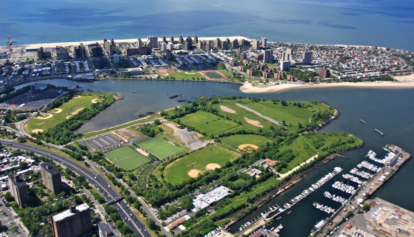
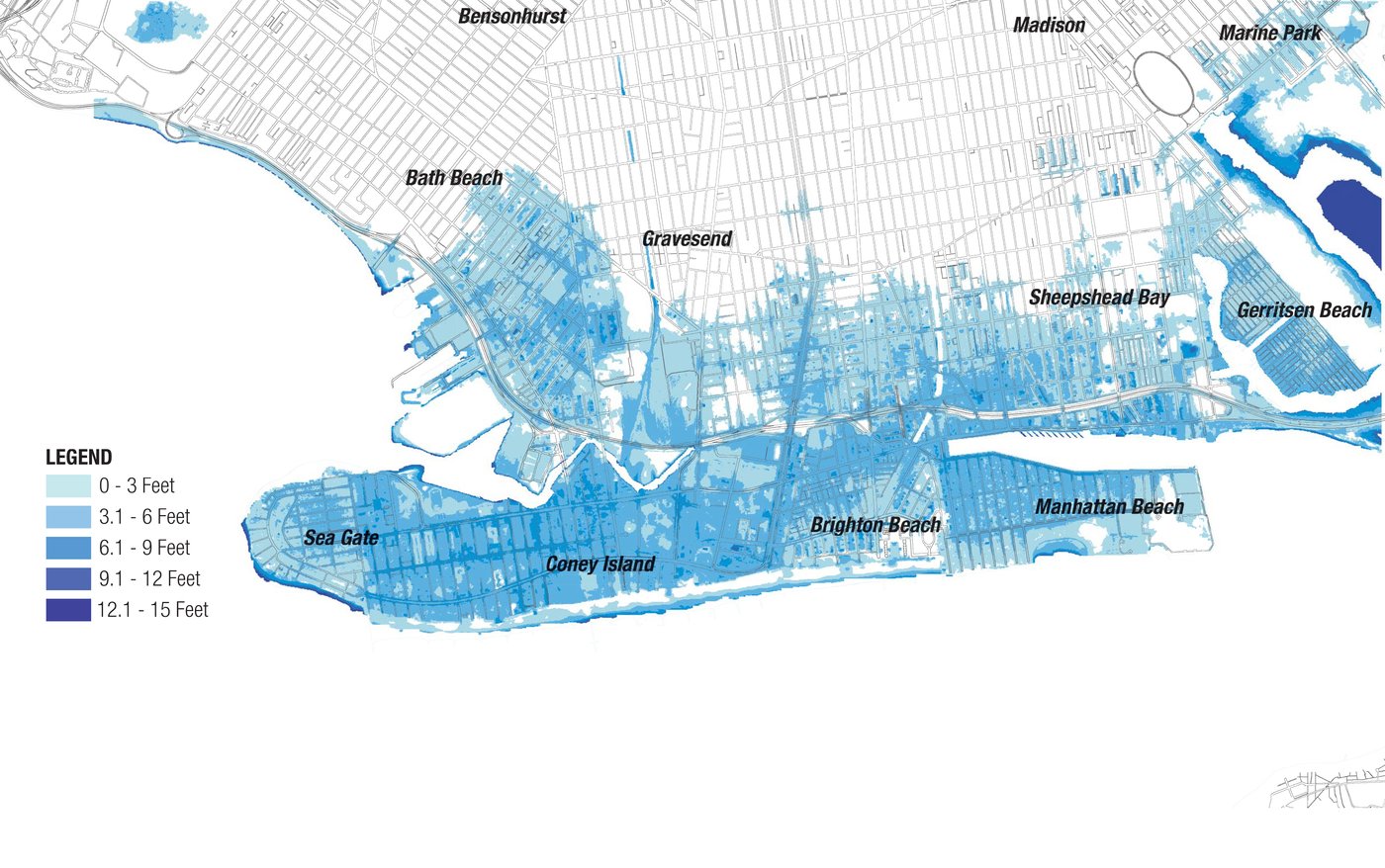
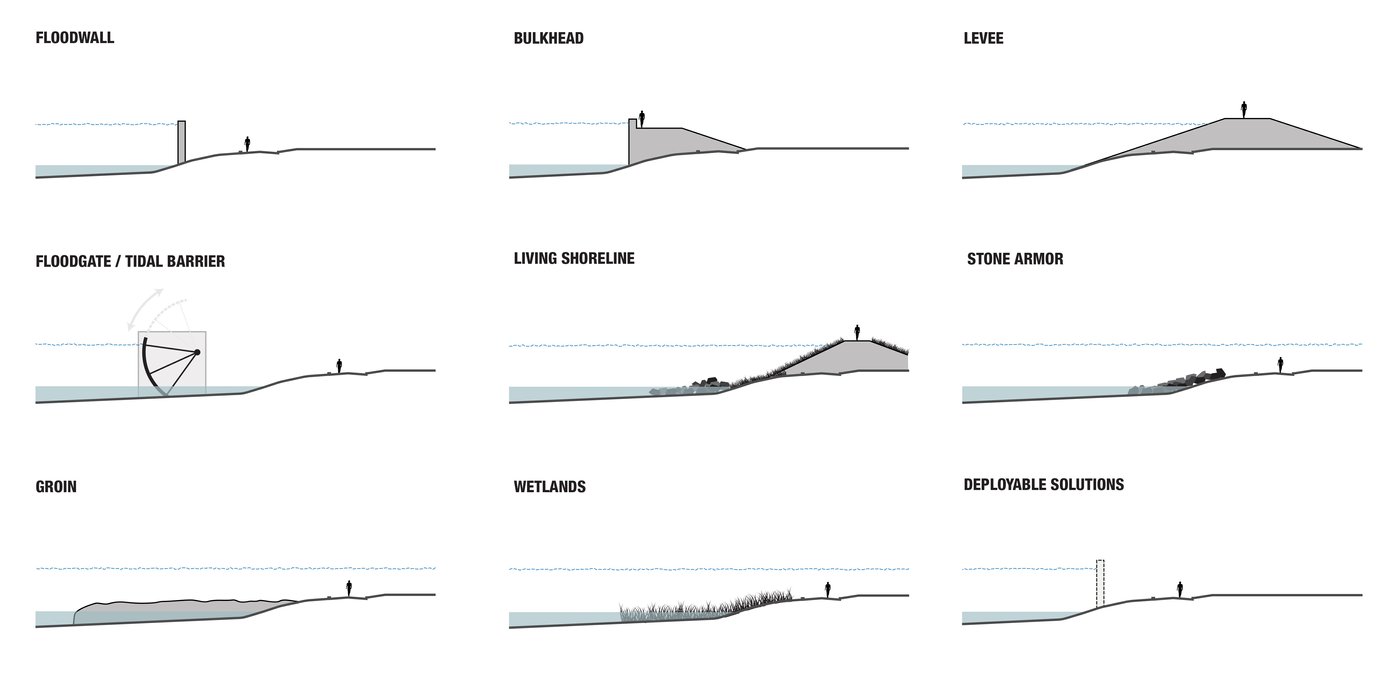
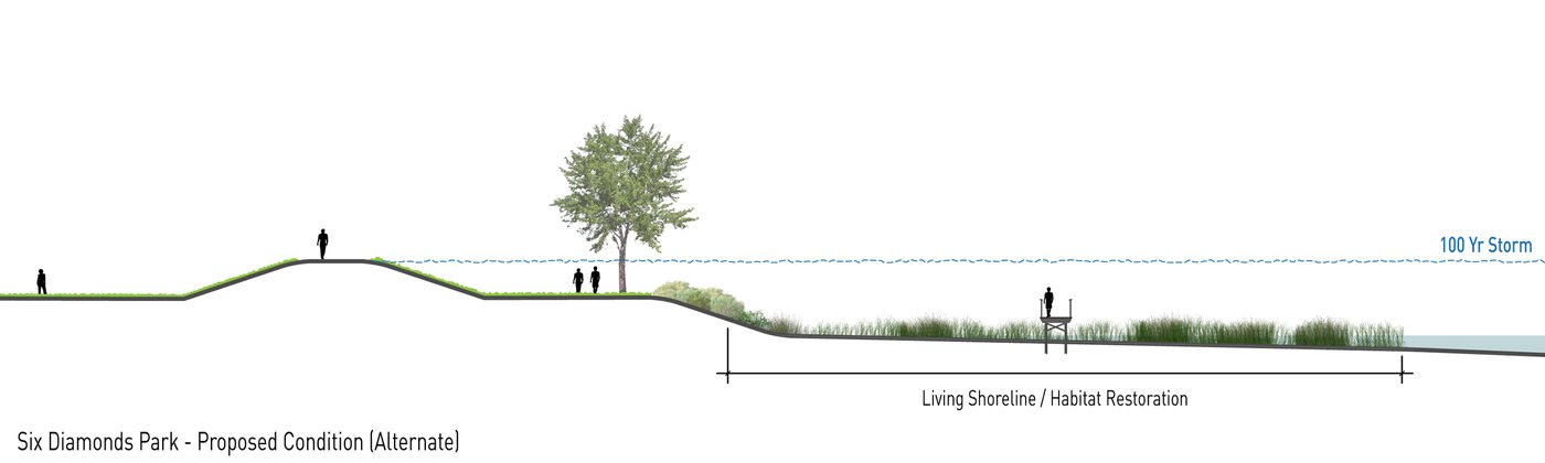
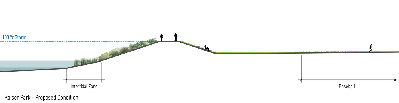
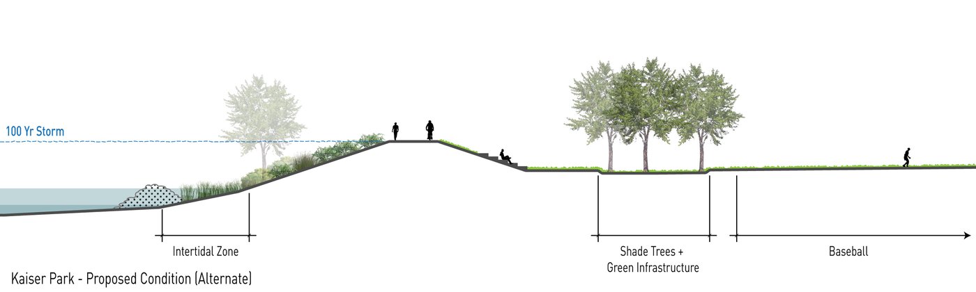
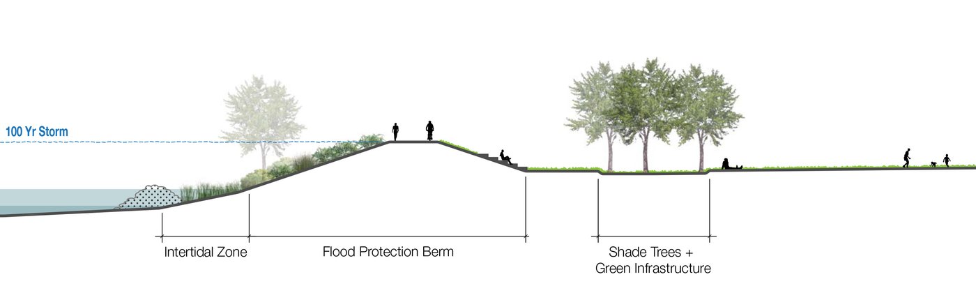
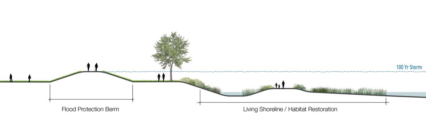
After Superstorm Sandy damaged low-lying neighborhoods in New York City, a variety of resiliency and flood protection measures were proposed through several city-sponsored initiatives. One such proposal, a tidal barrier and restored wetland at the mouth of Coney Island Creek, was developed during the Special Initiative for Rebuilding and Resiliency.
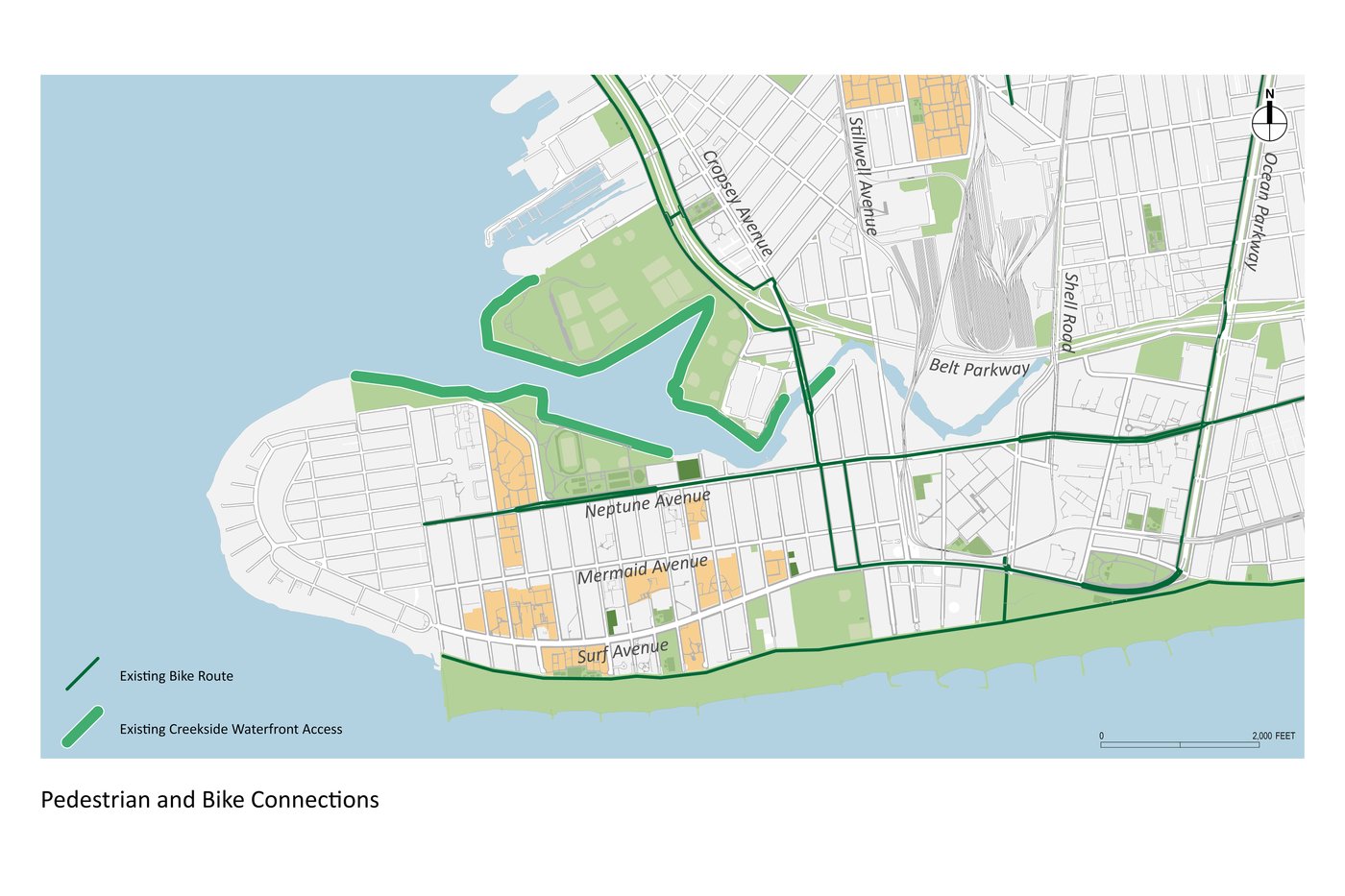
The New York City Economic Development Corporation, in collaboration with other city, state, and federal agencies, administered the project, which tested the feasibility of this flood protection concept. MNLA worked with the engineering team that studied integrated hydrologic management strategies that can be used to prevent and mitigate upland flooding around Coney Island Creek. The firm led the Community Connections and Open Space component of the study and collaborated across disciplines to develop recommendations for flood protection that have a positive impact on open space. MNLA also considered how these interventions would affect circulation, views, ecology, and existing neighborhood fabric. The project team ultimately delivered a vision for the area with design guidelines that help maximize the secondary benefits of flood protection.
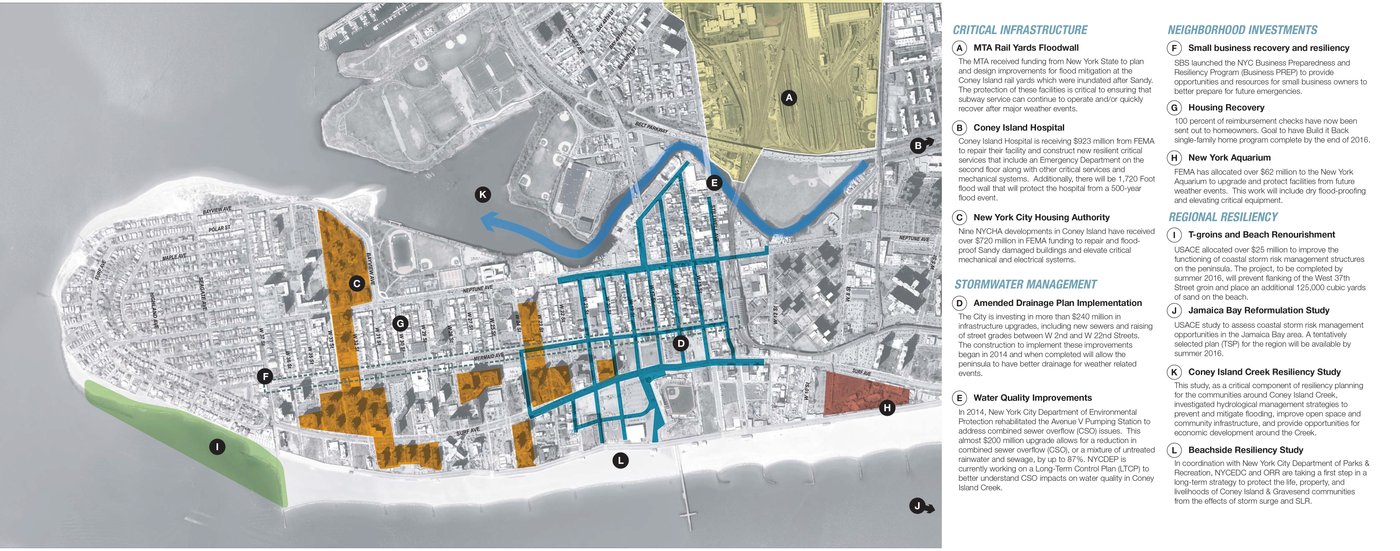
The Coney Island Creek Tidal Barrier and Wetlands Feasibility Study was featured in "Civil Engineering", the magazine of the American Society of Civil Engineers.