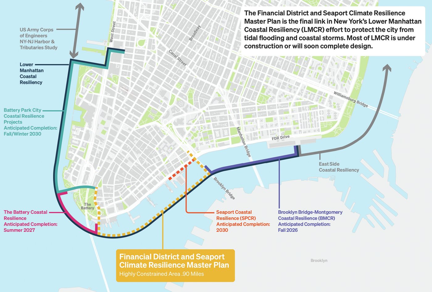
The Financial District and Seaport Climate Resilience Master Plan is the final link in New York’s Lower Manhattan Coastal Resiliency (LMCR) effort to protect the city from tidal flooding and coastal storms. The comprehensive vision leverages the need for coastal flood protection to transform one mile of lower Manhattan’s most complex and valuable shoreline into a resilient and dynamic waterfront for the next generation of New Yorkers.
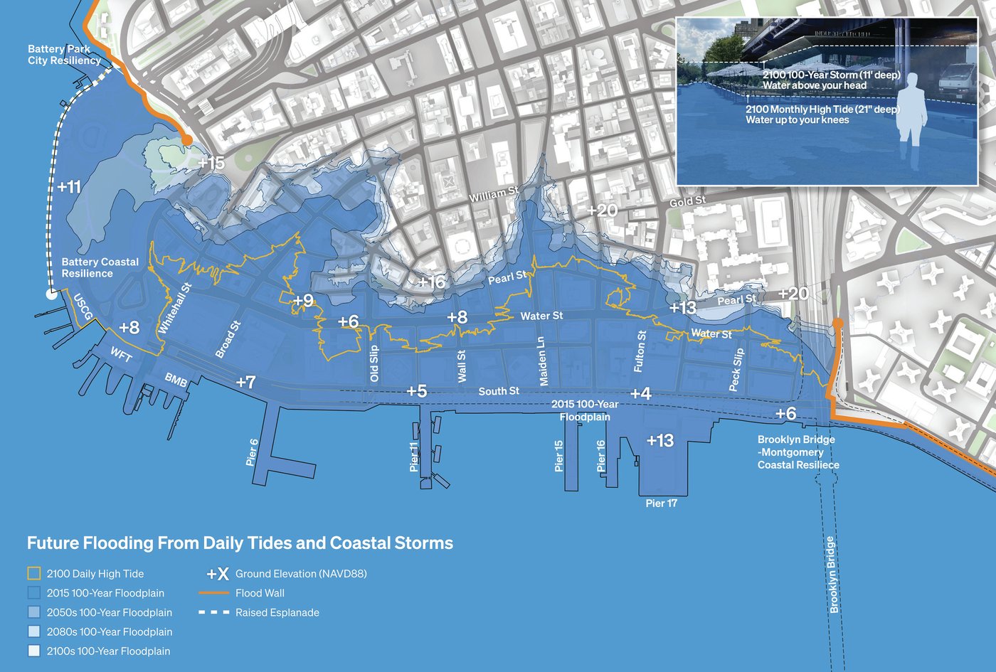
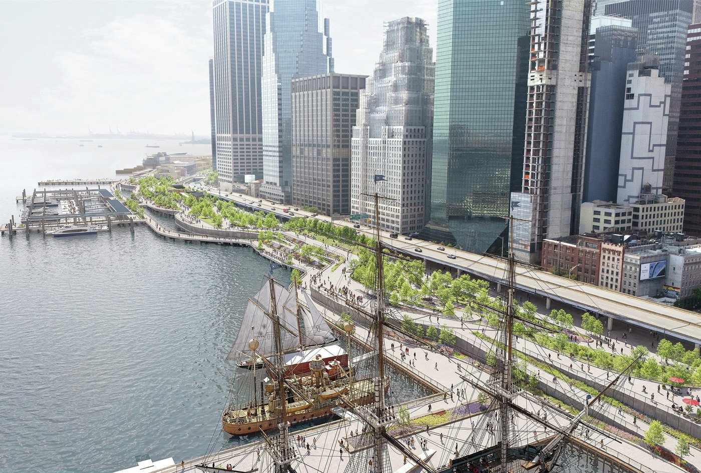
Spanning from the Brooklyn Bridge to The Battery, the FiDi-Seaport waterfront is also some of Manhattan’s most vulnerable—by the 2050’s, tidal flooding will become a frequent occurrence, and by 2100, coastal storms could bring over 15’ high storm surge flooding. Intensified precipitation and extreme heat pose additional environmental challenges. Within the project area, a dense concentration of historic urban fabric, significant landmarks, five subway lines, a highway, several active ferry terminals, critical utility and sewer corridors, and an existing constrained waterfront make traditional flood protection approaches difficult.
The Plan
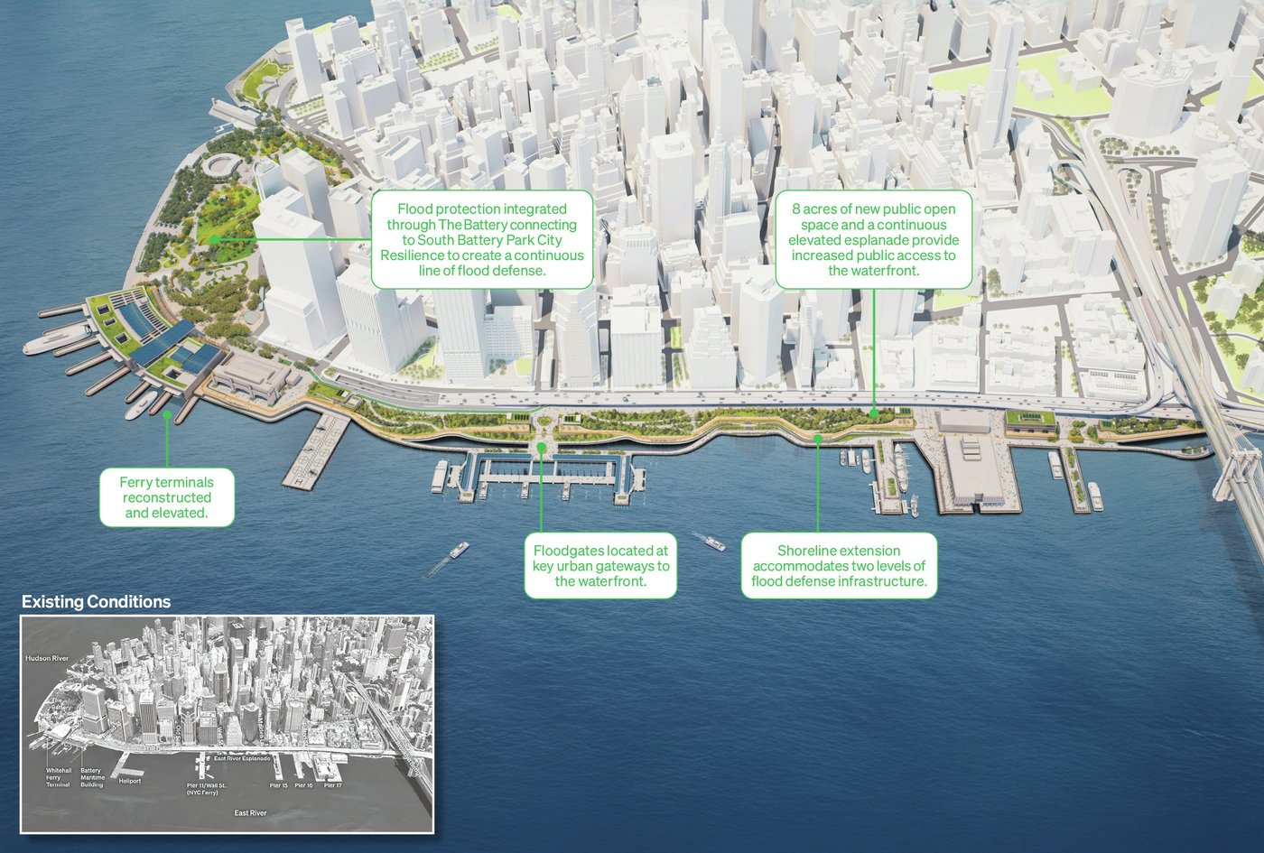
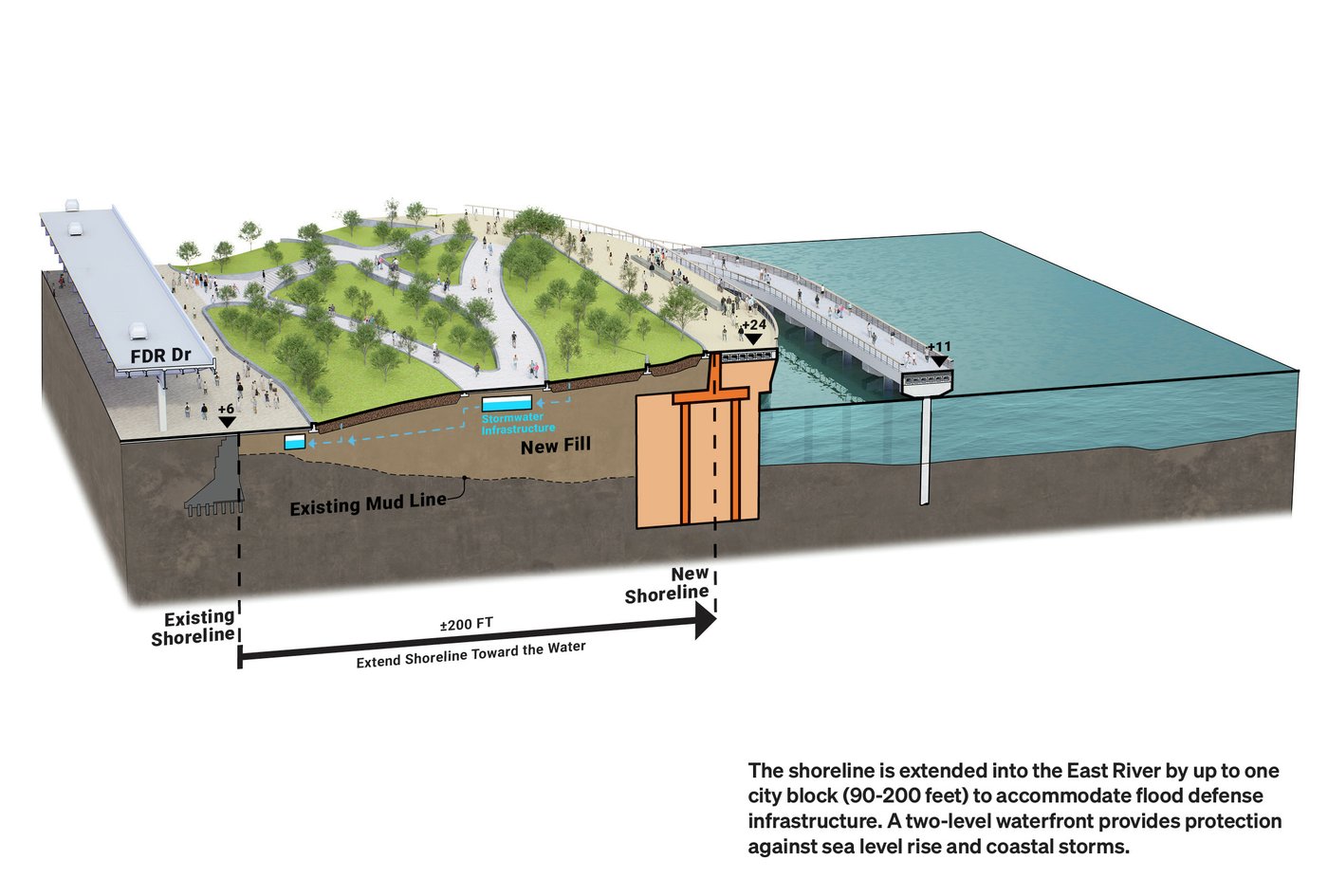
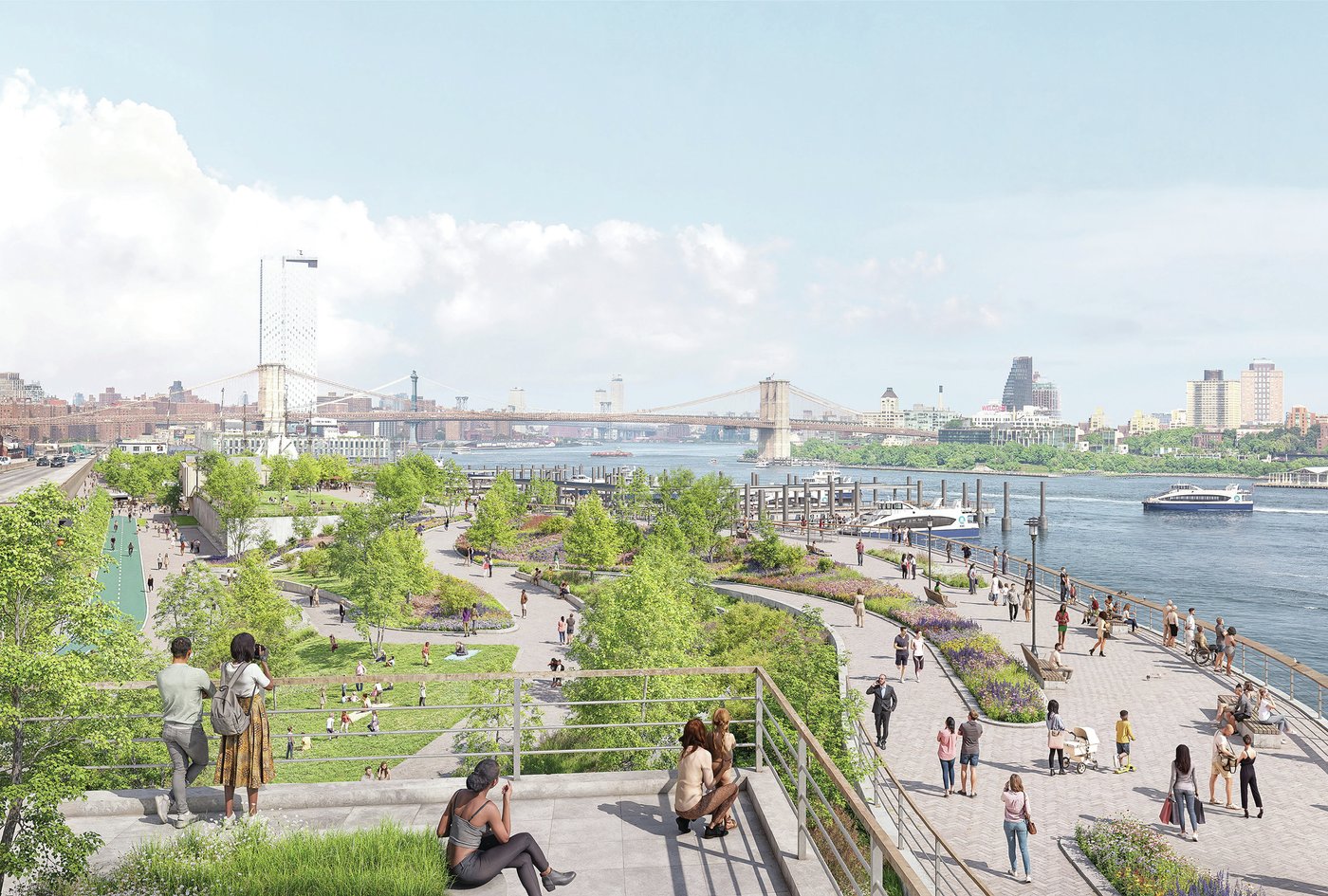
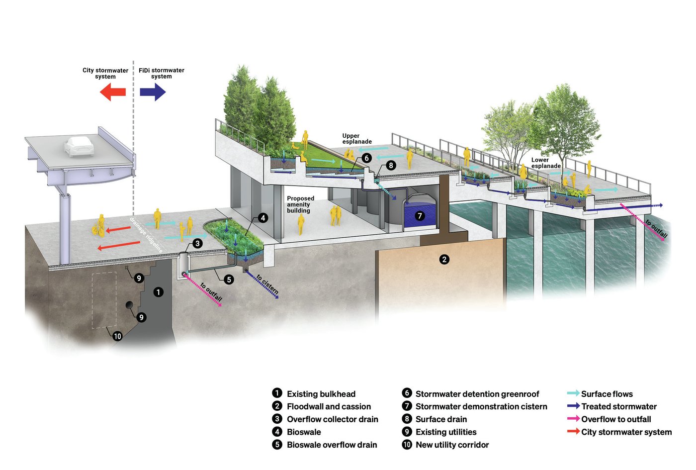
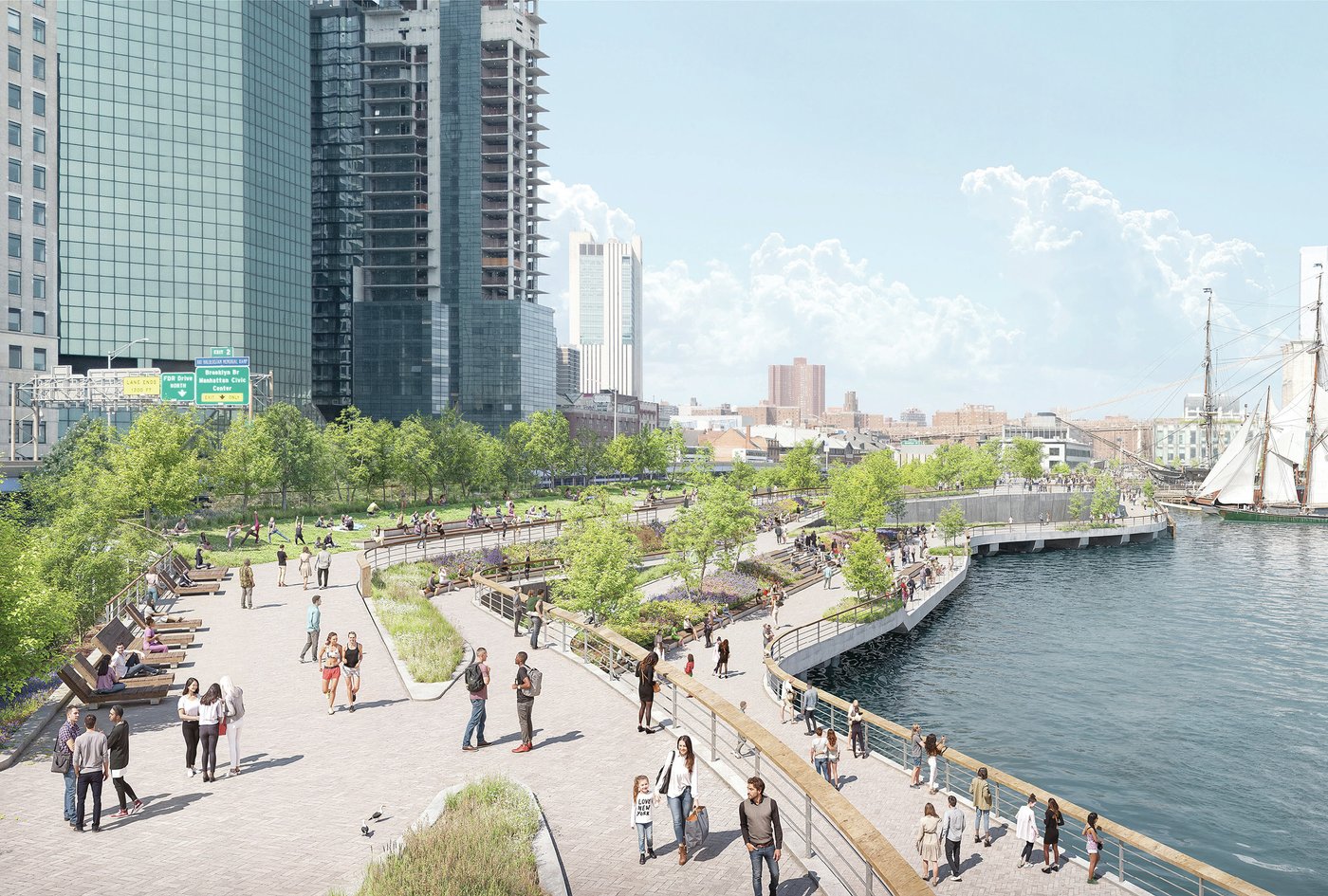
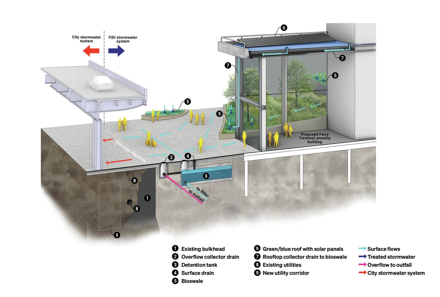
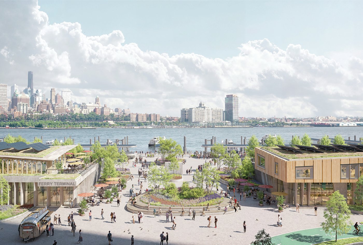
With limited room at the water’s edge to integrate new flood defense without walling off the city from the water, the city’s Plan proposes a bold solution—extend the shoreline into the East River by up to 200’ to accommodate the flood defense within 8 acres of new waterfront open space.
By embedding the flood defense into the shoreline extension, the proposed design conceals two types of flood protection and drainage infrastructure within a new multi-level public park. At the lower level, a waterfront esplanade is designed above tidal flooding elevations to maintain continuous waterfront circulation and connections to new resilient maritime facilities. At the upper level, a series of elevated public open spaces bring users up and over the highest level of flood protection, maintaining views and universally accessible connections to both the city and the water.
Working within a collaborative team of interdisciplinary design consultants to build upon previous phase work, MNLA’s design role in the recent phase of the masterplan included open space design, urban and waterfront access and connectivity, stormwater strategies, in-water and on-land opportunities for ecology and biodiversity, and establishing sensitive connections to existing urban conditions where the project ties in at high ground and adjacent LMCR projects, with a particular focus on the historic park at The Battery. This final phase of the masterplan progressed and completed the initial concept into an implementable design package that will allow for critical Environmental Review and Permitting phases to commence.
Cultivating a City-Community Vision
Critical to the Plan’s success is the cultivation of a diverse coalition of support from community members, City agency partners, ferry operators, maritime users, environmental advocates, historic stewards, and other key stakeholders such as the Climate Coalition of Lower Manhattan (CCLM).
During the most recent phase of work, MNLA played a critical role in leading the strategy and execution of a broad-reaching community engagement effort aimed at increasing awareness, gathering input, and building the support that will be necessary to carry momentum for the long-term vision of the project forward through future phases.