AKRF
BIG
Boomi
CH2MHill
Hazen & Sawyer
Hardesty & Hanover
IMEG
KS Engineers
MNLA
Munoz
One
Siteworks
Wesler Cohen
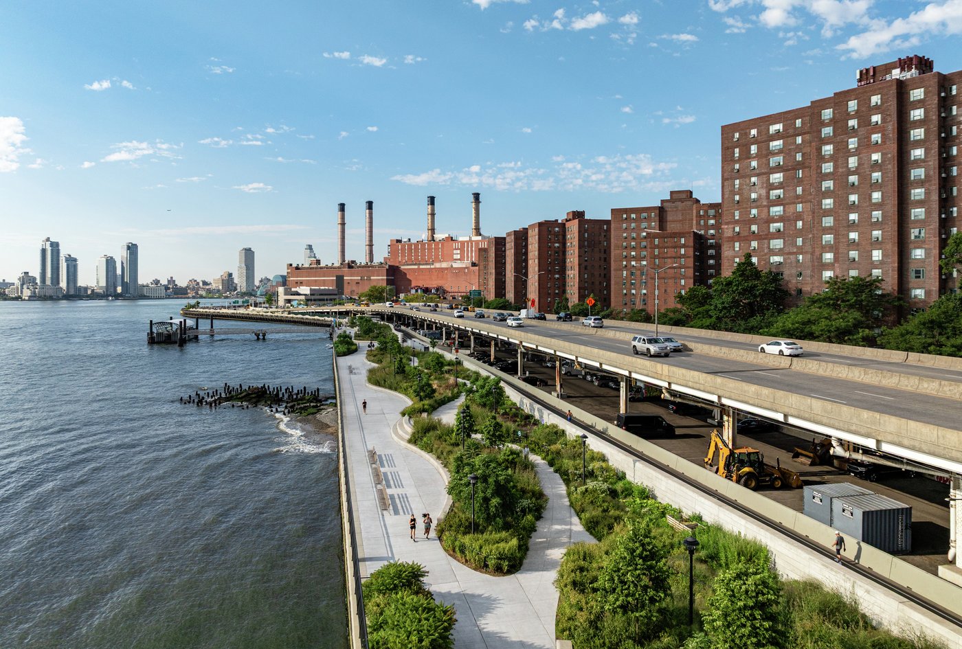
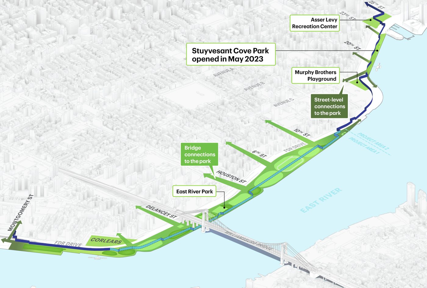
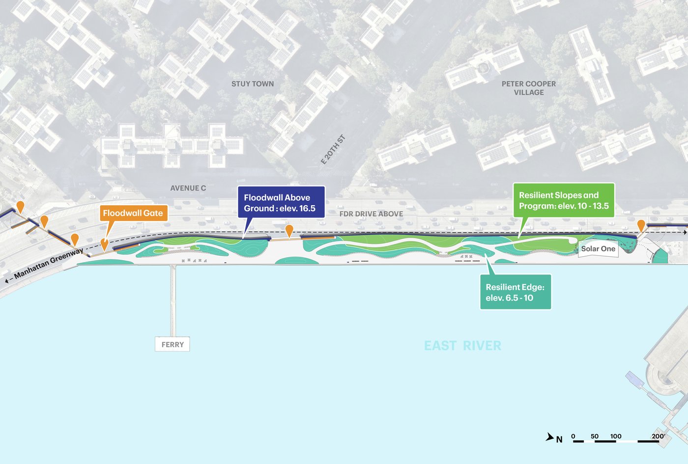
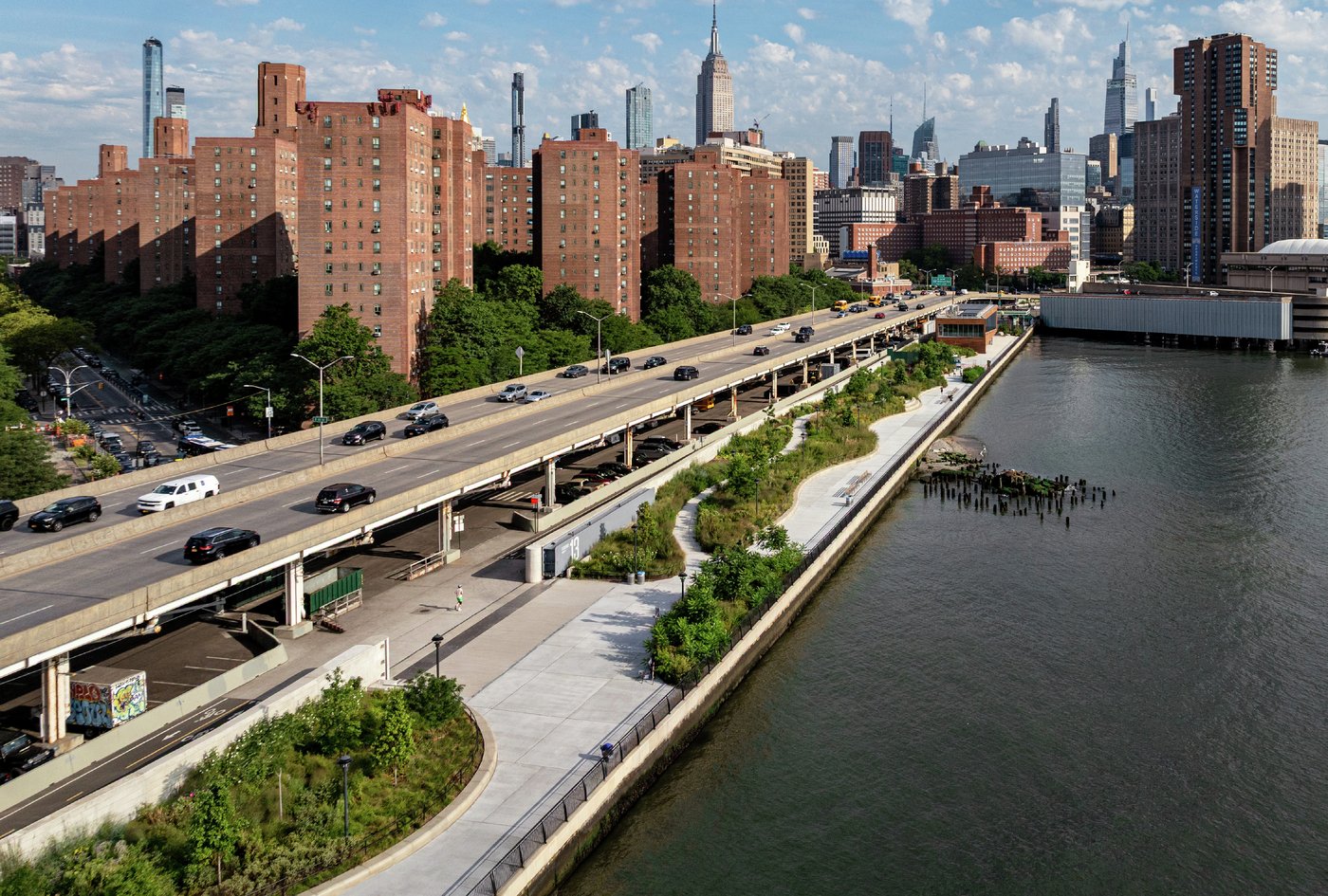
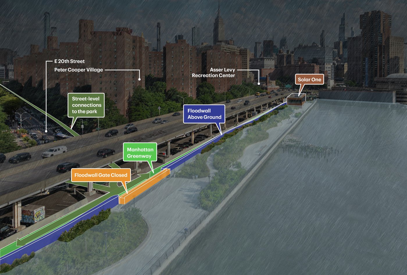
The completion of Stuyvesant Cove Park marks a major milestone in New York City’s first large-scale effort to protect Lower Manhattan from sea level rise and coastal flooding following Hurricane Sandy. Part of the East Side Coastal Resiliency (ESCR) project, this transformative initiative re-imagines how community, nature, and critical infrastructure can coexist, providing flood protection for more than 110,000 residents while enhancing access, resilience, and quality of life along the waterfront.
The overall intent of ESCR is to seamlessly weave FEMA-certified flood protection infrastructure through, above, and below a series of open spaces lining the East River in Lower Manhattan. MNLA, in collaboration with a multidisciplinary team of engineers and designers, shaped a dynamic landscape that blends innovative topography and resilient vegetation to create an immersive park experience.
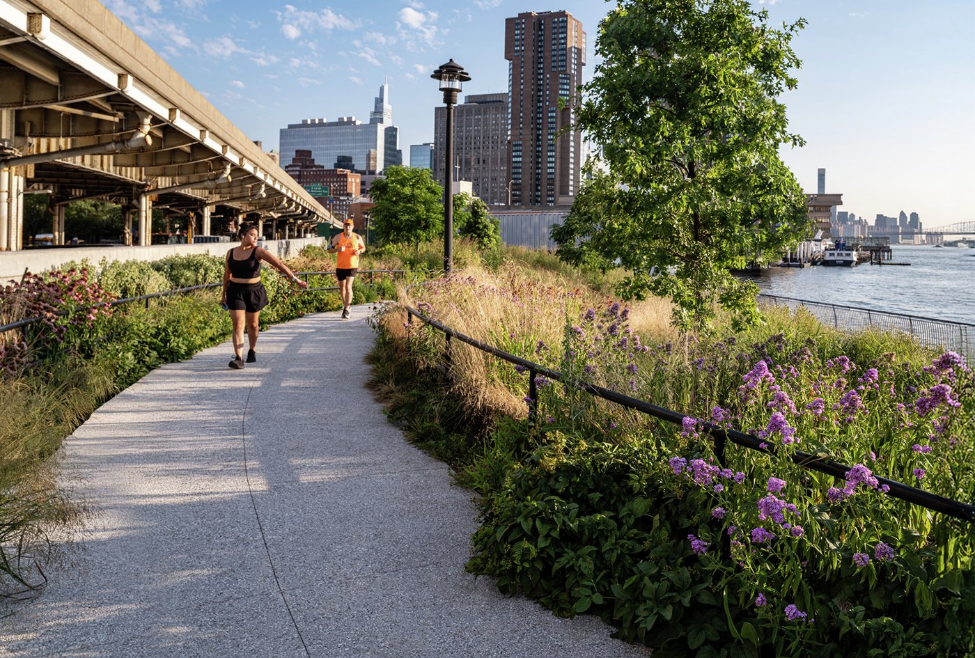
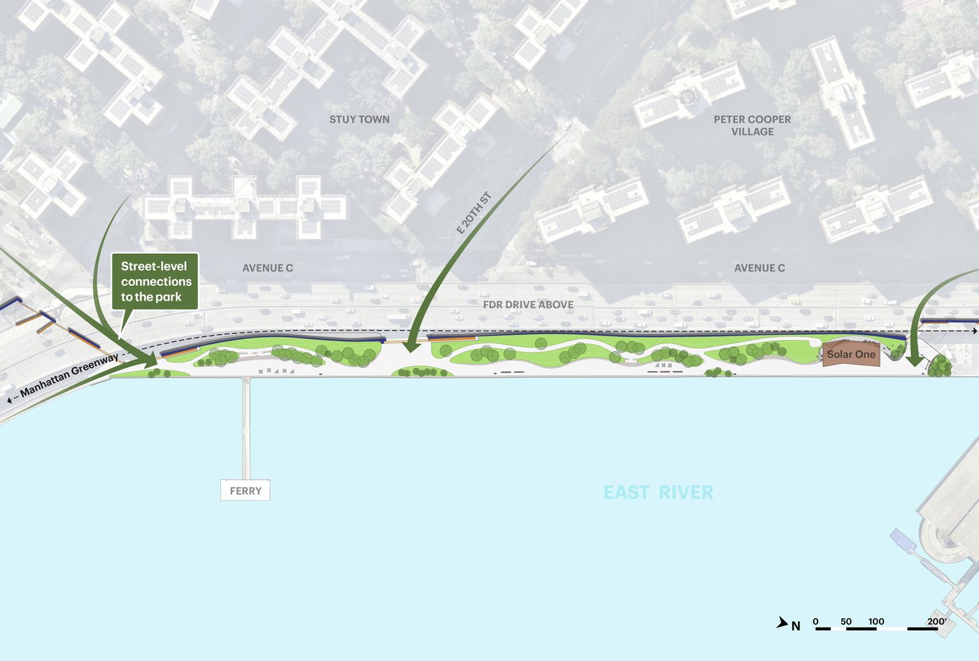
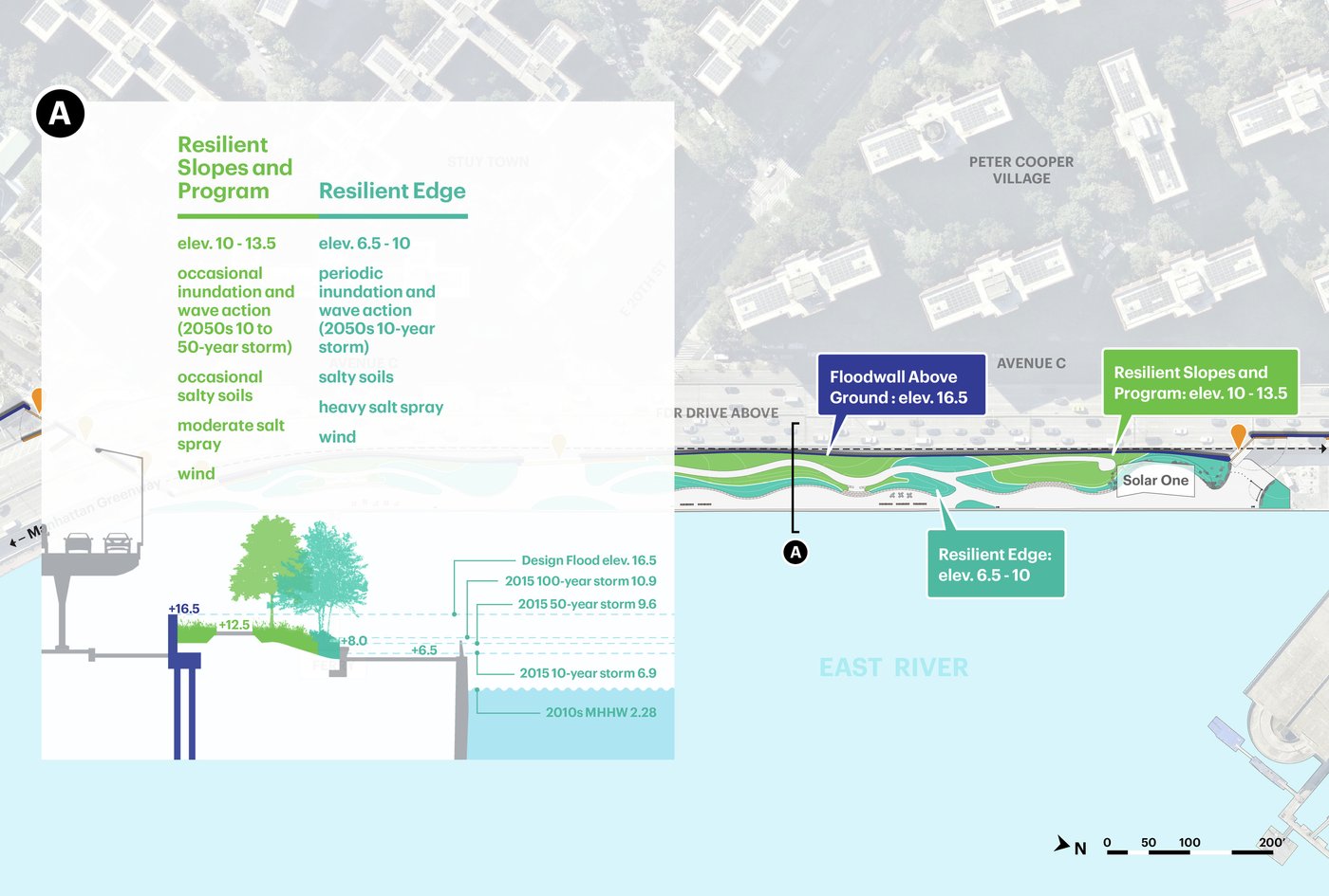
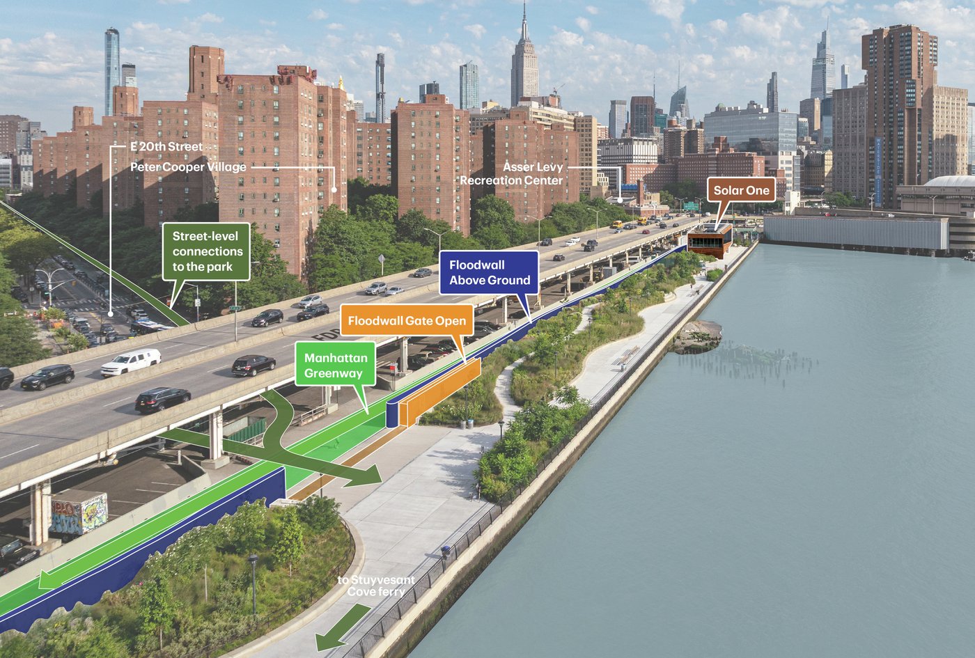
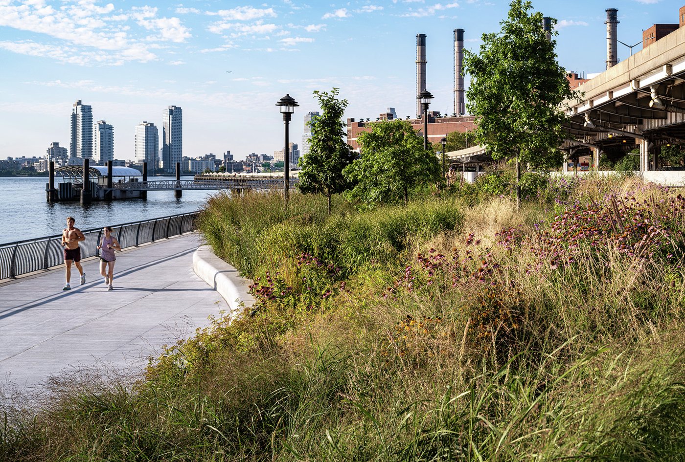
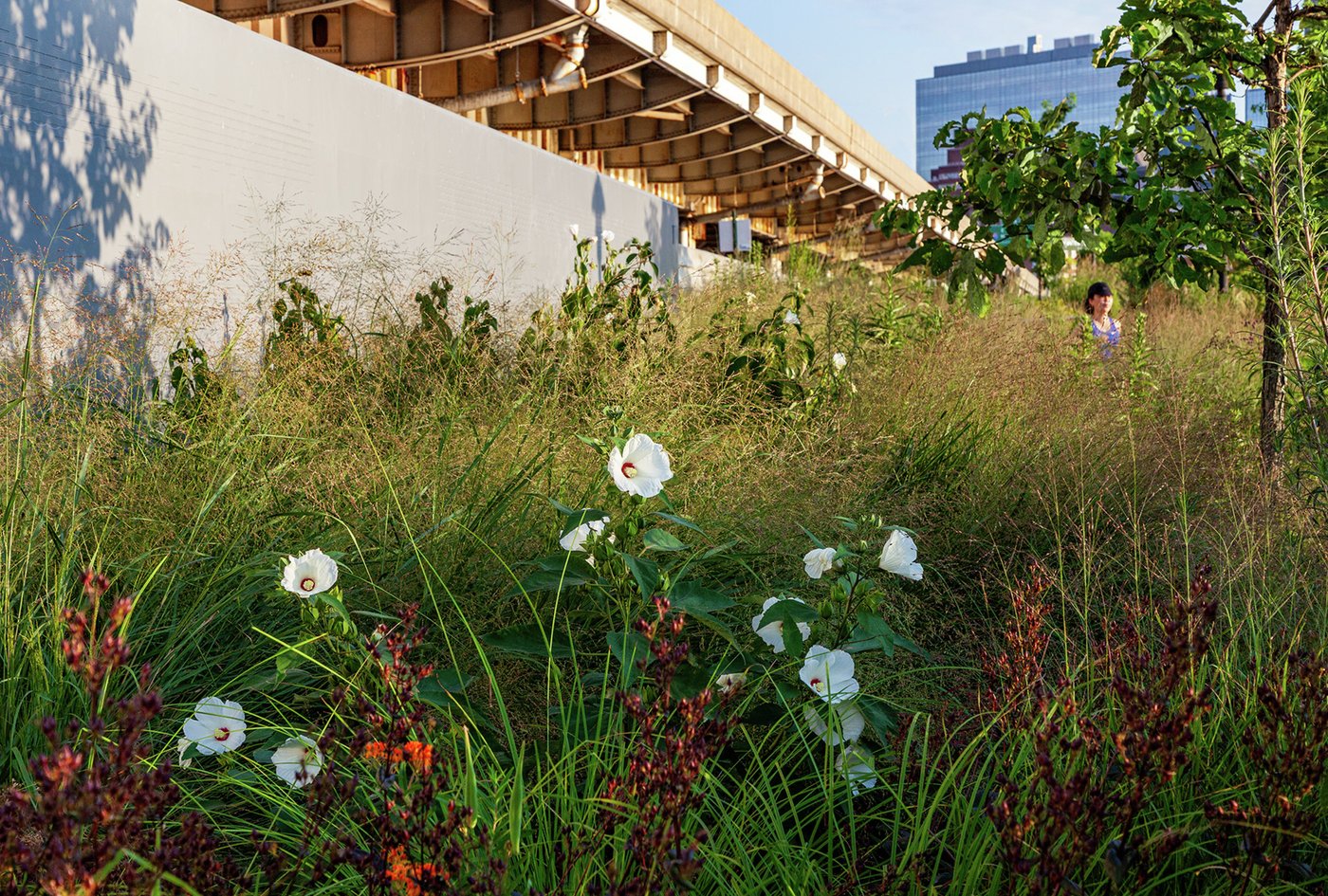
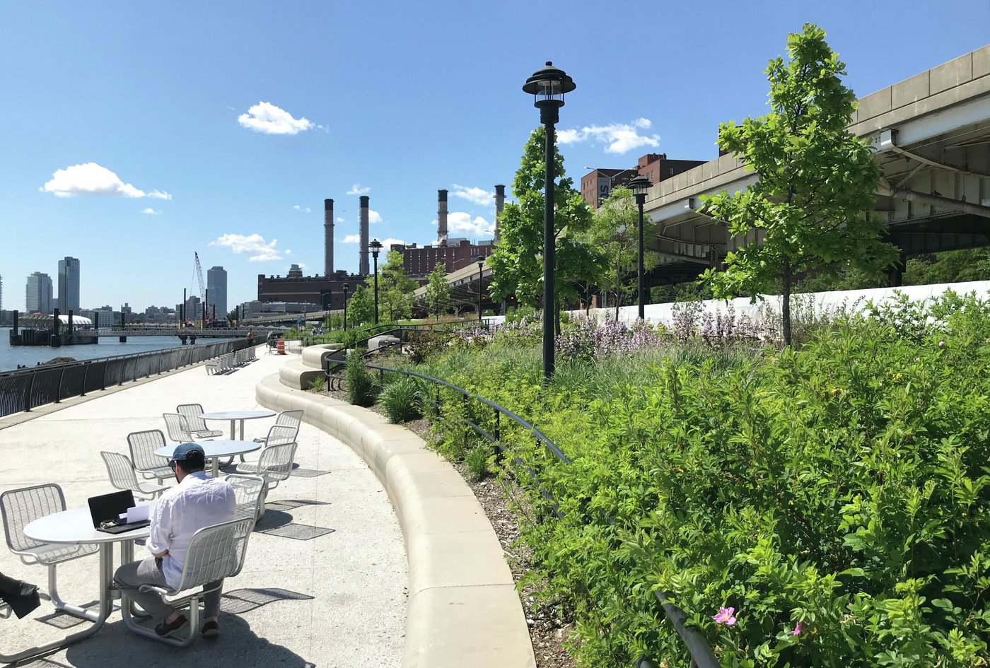
At Stuyvesant Cove, the narrow linear park—originating from a grassroots community initiative in the 1980s—is also the home of Solar One, a community environmental and education hub. In this segment of ESCR, the flood protection sits at the back of the park to buffer the noise of the adjacent FDR highway. The position of the floodwall results in both floodable and protected landscapes—during a storm event, Stuyvesant Cove is designed to flood. Therefore, the performance of the park is twofold: a floodable and resilient buffer of protection during storm events and an inviting public park and learning landscape during day-to-day use.
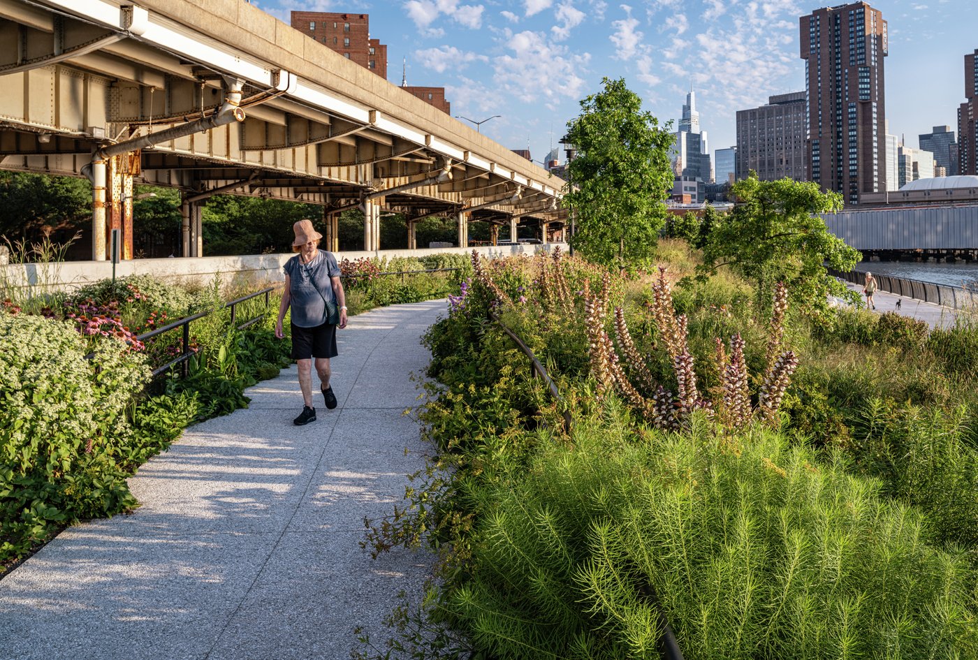
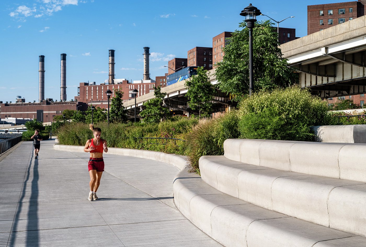
Topography in the cove supports this dual purpose. Elevated berms that rest against the floodwall provide varied program pockets within the park and mitigate wave action during a storm event. This topography gives the park a layered resiliency approach—the lower portion of the park (below 10 feet) is designed for periodic inundation with plant species that thrive in submersion, salty soils, heavy salt spray, and high winds. Plant species chosen for the upper portion of the park (above 10 feet) are chosen to flourish in high winds, moderate salt spray, and occasional inundation. Park access and circulation is likewise woven into this layered approach. A wide public esplanade at lower elevations provides direct connections through city gateways to the waterfront and clear access along the water’s edge to a ferry terminal and Solar One’s new Education Center, sited in the north of the park. A more meandering experiential route follows the elevated topographic berm and brings users through a palette of native plantings to various lookouts, rest areas, and program pockets.